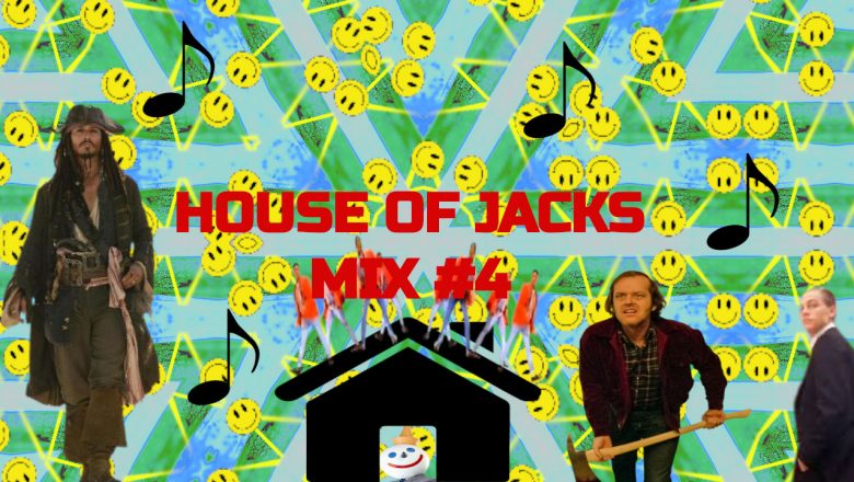
House Of Jacks Mix #3

Gas No LightHouse Of Jacks Mix III
{{svg_share_icon}}
  1. Kiss You In Paris
  2. Rockin’ Boats
  3. Higher (Take Me)
  4. Oi (U There) (Remix)
  5. Followers & Leaders
  6. After The Party Is The Party
  7. Chyld Please
  8. Shake In Rotations
  9. On & On (G.N.L. Remix)
  10. U Like (Remix)
  11. Dance For Inspiration
  12. Dripping
  13. Wanna Be Your Lover (G.N.L. Remix)
  14. Manic Dramatics (Remix)
  15. 4 Page Letter (G.N.L. Remix)
  16. Gimmie Some More (G.N.L. Remix)
  17. Nightlife
  18. Baby Can Dance (Hi Baby)
  19. As We Go Round
  20. Shorty Don’t Give It Up

Podcast Post – Attack Of The Heart

September 16, 2024

ATTACK OF THE HEART

INFO

Now I’m not sure if it’s called Heart Attack Hill or if we just made it up but the official name is Star Hill and is just off the Beaufort monument and near the woods called Barn Wood where a headless horse is meant to ride in and out of the woods. Also inside Barn Woods they trees and bushes weave in and out in this weird motion which is said to be quite creepy. I’ve walked in those woods with my dog Patch alone and saw something like that and it also scared me and made me run quicker to the safe zone. Star Hill which might also be called Heart Attack Hill is where I started getting heartburn and is where I sprained my ankle walking on the uneven footpath that leads to Barn Woods. It’s just a couple of strides to the hill but it’s quite steep and breathtaking.

Something I didn’t mention but it’s next to an old asylum that is now been converted into flats. The house was built in 1553 by Sir Richard Berkeley. Rebuilt by Norborne Berkeley, 4th Baron Botetourt circa 1760, it eventually became used as a dower house by the dukes of Beaufort at nearby Badminton House. This included Charles Somerset, 4th Duke of Beaufort (the son of Henry Somerset, 2nd Duke of Beaufort) and wife Elizabeth Somerset, Duchess of Beaufort whose daughter’s obelisk can be found to this date on the hill she died on from falling off a horse. The Dower House from the north-east. It was used as part of Stoke Park Hospital, previously Stoke Park Colony, from 1909. The house closed as a hospital wards in November 1986 when the final remaining patients were moved to other wards, though the laundry remained for a period. The building was sold in 1991 to the Sennett and Neate families who planned to redevelop the house into a nursing home, and it was rented to the nearby University of the West of England (UWE) for lectures and seminars in the interim, while the facilities at the Frenchay campus were redeveloped. The Dower House, Stoke Park is a dower house in Bristol, England. It is one of Bristol’s more prominent landmarks, set on Purdown, a hill above the M32 motorway on the main approach into the city, and painted yellow.

Podcast Post – Grab In The Night

September 16, 2024

GRAB IN THE NIGHT

HISTORY

There are pleasant walks along the steep wooded banks of the River Frome, for example to Oldbury Court. The park was purchased in 1926 by the Corporation of Bristol as “a pleasure walk for citizens of Bristol” and restored in the 1980s by the Fishponds Local History Society. The park’s name originates from one of the millers. His nickname was ‘Snuffy Jack’ because his smock was always covered in snuff. The park includes an old quarry and a stone mill. The old mill within the park was used for cutting and crushing stone from the many quarries along the Frome Valley during the late 19th century. It contains a waterwheel, and an egg-ended boiler in its setting and the remains  of a vertical steam engine.

Despite the name, tobacco snuff was never ground in this mill. Today, Snuff Mills is still a popular site for locals and visitors who come to enjoy the tranquillity and natural surroundings. This stretch of the River Frome is also home to some of Bristol’s otters. The Snuff Mill Park was purchased by the Bristol Corporation in 1926 for 1,000 guineas. At that time the portion of the mill building nearest the river Frome was still three storeys high. In the early 1930s, for reasons of public safety, the authorities collapsed the two upper floors of the ancient building into the lower storey and capped off the remains with tarmac and used it as a bandstand for Sunday afternoon concerts. About the same time, the mill house, stable, piggeries, wagon house and sheds’, all standing at right angles to the river Frome, were also demolished making way for the present ranger’s house which was built in 1936. Although the mill building is popularly known as “The Snuff Mill” no evidence has ever come to light to confirm that snuff was ground here. That distinction must surely rest with the mill, upstream “Witherly’s” (see Owen Ward BIAS Journal, 1969, “The Mills on the Bristol Frome”) where snuff was ground from around 1790. The mill was purchased by H.O.Wills in 1805 and ground snuff until 1843. It is from this mill that the legend of “Snuffy Jack” originates, the miller whose smock was always covered with snuff.

Chester Masters’ map of 1610 labels the mill under discussion as “Whitwood” and shows four other mills along the Stapleton Frome. From the Wessex Water Authority’s drawing, showing the location of the weir structures and their crest levels above Ordnance Datum it is possible to calculate the fall of water level from Frenchay to Lathbury Mill, Eastville Park as 25.46 m. or 823 ft. From Kings Mill to Lathbury the fall is 68 ft. 3 in. As the river is contained within a gorge it has cut for itself, the flow through the Stapleton valley is considerable and this may explain why none of the five mills needed mill ponds, each taking their water directly from the river above weirs. When the Bristol Avon River Authority kept records at Frenchay in 1975, their study showed the water flow varied from 200 cubic feet per second to over 2,000 cubic feet per second, all within a week. No doubt this variation reflects the relatively short length of the Frome, rising in the grounds of Doddington House and flowing to meet the Avon in Bristol some 19 miles away. The “Snuff Mill” or, more properly, Whitwood Mill is not mentioned in Domesday but documentary evidence indicates the presence of a mill on this site since 1297. A structure of this age has probably been rebuilt on many occasions with an “Engine Room” as a later addition. One can certainly find pieces of worn and broken millstones incorporated in existing walls. Over the years the mill has had many occupiers. The Stapleton Muster Roll of 1608, a list of able-bodied men available to the King in time of war, includes “John Whitewood, Miller, aged about 40, tall and a trained soldier. Iaacs Taylor’s map of 1777 refers to the mill as “Bridgemans”, while the Minute Book of the Kingswood Enclosure Commissioners (Stapleton Enclosure Act of 1779) states that one Samuel Punter of Whitchurch, Somerset, claimed “right of common” as owner of a messuage (house) water grist mill and about 11 acres of land, situated at Beach Hill, Stapleton, at that time in the tenure of Benjamin Bridgeman, at a yearly rent of £44. Benjamin’s will was proved in 1784 but his widow Martha and their son Joseph managed to hold on to the property until 1823, when Martha died.

Whitwood was purchased by Charles Hopkins for £1,250, whose milling career was to end in bankruptcy some 18 years later. 1841 saw the mill again advertised for sale, but it was not disposed of, to Thomas Jones, until 1846. Thomas Jones’s tenure was brief indeed for by 21 June 1846 his will was proved. The mill now passed into the hands of Josiah Bell who must have had the necessary qualities to run the mill competently for he was still occupier and eventual owner for some 41 years. A conveyance of 1866 refers to Josiah as a “Carpenter and Builder”. Perhaps he carried on both occupations, working in the building trade when the mill was quiet or the water level too low to turn the wheel. It was during Bell’s tenure that the 12 hp steam engine was installed in the mill to augment the water power. On 30 August 1879, J. Bell, Miller of Stapleton, was granted an outdoor beer licence at the mill house. Ownership of the Mill House Off Licence passed into the hands of the Ashton Gate Brewery Co. with John Dyke the local postman as tenant. By 1896 poor John Dyke had to get his licence transferred to Primrose Cottage, near the Frome bridge, because there were fears that sewage from the Infectious Diseases Hospital, situated on the high ground behind his beer house, would contaminate his well. In 1889 Josiah Bell put Whitwood Mill up for sale. Lot 3 of the auctioneer’s hand bill stated that the premises included “…the Ground Floor and Three Lofts, the upper loft being 52 ft. by 182 ft. There is also a capital Stable, Piggeries, Wagon House and Sheds. The Machinery comprises … a 12 Horse-Power Engine, a 12 Horse-Power Water Wheel, three Pairs of Stones, an Oat, Malt, and Bean Crusher, and a Dressing Mill”. The sale included the house, orchard, valuable building site and quarry comprising a frontage of 170 ft. to Snuff Mill Lane and notes that “…It is believed that valuable Pennant stone lies under Lots 2,4, and 5”. The mill was sold to Maberly Parker for £565, the price probably reflecting the dwindling use of water as a power source, with the steam providing a more convenient and controllable source of industrial power. Maberly Parker quarried Pennant stone from behind the mill building and several sites along the river towards Frenchay.

Chester Masters’ map of 1610 labels the mill under discussion as “Whitwood” and shows four other mills along the Stapleton Frome. From the Wessex Water Authority’s drawing, showing the location of the weir structures and their crest levels above Ordnance Datum it is possible to calculate the fall of water level from Frenchay to Lathbury Mill, Eastville Park as 25.46 m. or 823 ft. From Kings Mill to Lathbury the fall is 68 ft. 3 in. As the river is contained within a gorge it has cut for itself, the flow through the Stapleton valley is considerable and this may explain why none of the five mills needed mill ponds, each taking their water directly from the river above weirs. When the Bristol Avon River Authority kept records at Frenchay in 1975, their study showed the water flow varied from 200 cubic feet per second to over 2,000 cubic feet per second, all within a week. No doubt this variation reflects the relatively short length of the Frome, rising in the grounds of Doddington House and flowing to meet the Avon in Bristol some 19 miles away. The “Snuff Mill” or, more properly, Whitwood Mill is not mentioned in Domesday but documentary evidence indicates the presence of a mill on this site since 1297. A structure of this age has probably been rebuilt on many occasions with an “Engine Room” as a later addition. One can certainly find pieces of worn and broken millstones incorporated in existing walls. Over the years the mill has had many occupiers. The Stapleton Muster Roll of 1608, a list of able-bodied men available to the King in time of war, includes “John Whitewood, Miller, aged about 40, tall and a trained soldier. Iaacs Taylor’s map of 1777 refers to the mill as “Bridgemans”, while the Minute Book of the Kingswood Enclosure Commissioners (Stapleton Enclosure Act of 1779) states that one Samuel Punter of Whitchurch, Somerset, claimed “right of common” as owner of a messuage (house) water grist mill and about 11 acres of land, situated at Beach Hill, Stapleton, at that time in the tenure of Benjamin Bridgeman, at a yearly rent of £44. Benjamin’s will was proved in 1784 but his widow Martha and their son Joseph managed to hold on to the property until 1823, when Martha died.

Podcast Post – Fur Raiser

September 16, 2024

FUR RASIER

INFO

Here is where Patch went all weird and her fur stood up and she was staring in mid-air at nothing. We were stood at the gate of the graveyard where we were going to go in and take some pictures me and my friend but Patch started to act all funny so I went in and took some pictures by myself. I felt pretty scared and I felt alone and vulnerable walking in that graveyard but I knew nothing could hurt me apart from thugs but the roads were always pretty quiet on the weekdays so I had nothing to worry about. I was disappointed to not see any orbs come up and so was my friend probably or though I didn’t do it as he doesn’t mess with Juju or witchcraft he’s scared.

The graveyard and church are just off a main high street and weren’t scary until Patch started acting weird and sketchy. I have no idea what she was sensing but whatever it was it wasn’t a good thing and made us both sketch out. I still went into the cemetery to get some exclusive pictures for my website and other projects also at that time I was on Flickr. It’s also exciting going into a dark and lonely place to get some good material for later use I’m always bringing up my own photos and stuff for my projects and that all comes in handy. The church by the graveyard is called St Mary’s Church and is a church that barely gets used I saw one wedding taking place there but no Sunday services I’m not sure.

Podcast Post – Flashing Lights Ahead

September 15, 2024

FLASHING LIGHTS AHEAD

INFO

It’s scary enough being in the dark on the Cycle Path/the old railway station/the old Dramway let alone seeing a train header light ahead and then disappearing into the night. We were on paths like this and were one straight path that led to the next town or village. It was around 8.30 PM near winter so it gets dark early so I wondered if they saw me with my hood on coming their way and turned around. The light was quite bright and shined bright into the now nighttime or though I would say it was three-quarters dark outside and the light was 0.3 miles away maybe 0.4 and wasn’t that far away basically it would have taken a couple of minutes to walk to where the light was shining.  

As I said before there is only one path and the bit it disappeared into doesn’t wind around and you turn a slight corner to another straight path that only cuts off when you get to Mangotsfield Station. It  is around a seven-minute walk from the pencils just off the dual carriageway and walking away from a place called Emerson Green. I’ve walked that route many times now and never saw a way to follow the dual carriageway and you had to pass Mangotsfield Station to get back to society which is in a place called Kingswood or really it’s called Soundwell which is heading for more town and urban streets rather than country lanes and a whole lot of cows mooing at you.